Mt. Chokai (Hokodate)
Open by month
Closed in January. New Year (Dec 29 – Jan 3): closed.
Closed in February.
Closed in March.
Partly closed in April: some days or parts are closed — see the official site.
Open in May. No seasonal closure recorded.
Open in June. No seasonal closure recorded.
Open in July. No seasonal closure recorded.
Open in August. No seasonal closure recorded.
Open in September. No seasonal closure recorded.
Open in October. No seasonal closure recorded.
Partly closed in November: some days or parts are closed — see the official site.
Closed in December. New Year (Dec 29 – Jan 3): closed.
Checked against the official site on 2026-10-15.
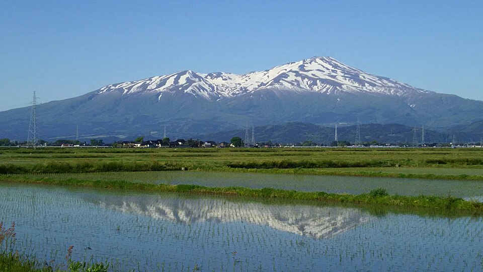
A 2,236 m volcano on the Akita–Yamagata border, nicknamed 'Dewa Fuji' and rising straight from the Sea of Japan. The Hokodate observatory at the fifth station looks over the sea and the V-shaped Naso Valley.
National Historic Site (Mt. Chokai); Chokaisan & Tobishima Geopark
Nearby
- Hottai Falls ≈ 30 min by car
- Mototaki Fukuryusui (Spring-fed Falls) ≈ 30 min by car
- Tamasudare Falls ≈ 30 min by car
- Maruike-sama Pond ≈ 35 min by car
- Juroku Rakan Iwa (Sixteen Arhats Rocks) ≈ 40 min by car
Travel times are rough estimates by car.
- Getting there
- About 35 min by car from JR Kisakata Sta. via the Chokai Blue Line (reservation-only climbers' bus on some weekends)
Easier with a tour or car - Good to know
- Chokai Blue Line open mid/late Apr to early Nov, closed at night (17:00–8:00) in spring and late autumn. Summit about 4.5 hrs on foot from Hokodate
- Time needed
- 2 h
Checked against the official Japanese website on 2026-10-15. Report outdated info