Mt. Bandai
Open by month
Open in January. No seasonal closure recorded.
Open in February. No seasonal closure recorded.
Open in March. No seasonal closure recorded.
Open in April. No seasonal closure recorded.
Partly closed in May: some days or parts are closed — see the official site.
Open in June. No seasonal closure recorded.
Open in July. No seasonal closure recorded.
Open in August. No seasonal closure recorded.
Open in September. No seasonal closure recorded.
Open in October. No seasonal closure recorded.
Open in November. No seasonal closure recorded.
Open in December. No seasonal closure recorded.
Checked against the official site on 2026-10-15.
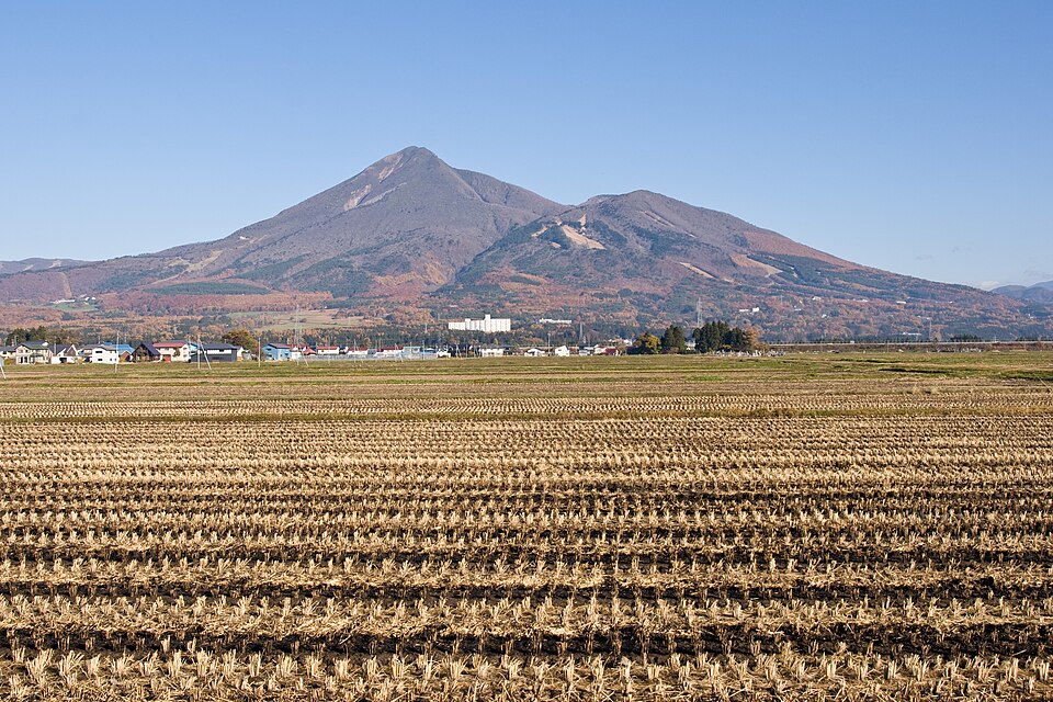
A 1,816 m volcano praised as the 'treasure mountain'. Its 1888 steam explosion collapsed the north side, damming rivers into Lake Hibara, the Goshikinuma ponds and other lakes; the raw collapse wall faces Urabandai.
Bandai-Asahi National Park; Bandaisan Geopark
Nearby
- Goshikinuma Ponds ≈ 20 min by car
- Hideyo Noguchi Memorial Museum ≈ 25 min by car
- Lake Inawashiro ≈ 25 min by car
- Nakatsugawa Gorge ≈ 30 min by car
- Aizu Clan School Nisshinkan ≈ 35 min by car
Travel times are rough estimates by car.
- Getting there
- Drive or take a taxi to the Happodai trailhead, e.g. from JR Inawashiro Station (no buses to the trailheads)
Easier with a tour or car - Good to know
- The mountain opens in late May; best climbing season late May to late October. From Happodai about 2 h 15 min up and 1 h 40 min down. No toilets on the trails (bring a portable toilet)
- Time needed
- 3 h
Checked against the official Japanese website on 2026-10-15. Report outdated info