Mt. Mizugaki
Open by month
Partly closed in January: some days or parts are closed — see the official site.
Partly closed in February: some days or parts are closed — see the official site.
Partly closed in March: some days or parts are closed — see the official site.
Partly closed in April: some days or parts are closed — see the official site.
Open in May. No seasonal closure recorded.
Open in June — at its best. Azuma rhododendrons along the trail in June; autumn leaves.
Open in July. No seasonal closure recorded.
Open in August. No seasonal closure recorded.
Open in September. No seasonal closure recorded.
Open in October. No seasonal closure recorded.
Partly closed in November: some days or parts are closed — see the official site.
Partly closed in December: some days or parts are closed — see the official site.
Checked against the official site on 2026-10-15.
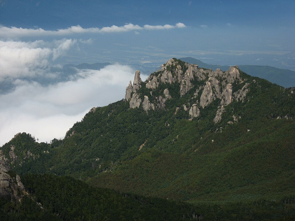
A 2,230 m granite peak crowned with jagged, saw-tooth rock pinnacles, the symbol of Hokuto City. A day hike (about 5.5 hours return) from the Mizugaki Sanso trailhead.
Nearby
- Nishizawa Gorge ≈ 40 min by car
- Seisenryo (Kiyosato Highlands) ≈ 40 min by car
- Shosenkyo Gorge ≈ 45 min by car
- Erinji Temple ≈ 50 min by car
- Sanbuichi Spring ≈ 50 min by car
Travel times are rough estimates by car.
- Best time
- June — Azuma rhododendrons along the trail in June; autumn leaves
- Getting there
- Seasonal Kyohoku Kotsu bus from JR Nirasaki Sta. to 'Mizugaki Sanso' (trailhead)
Few buses — check times or join a tour - Good to know
- Intermediate hike, about 5.5 h return, with chains on rocky sections. The forest road to the trailhead closes in winter (usually late Nov to late Apr) and after heavy rain or earthquakes
- Time needed
- 3 h
Checked against the official Japanese website on 2026-10-15. Report outdated info